See also the RpC article on the topic here:
https://g1.globo.com/pr/campos-gerais-sul/noticia/2019/07/25/projeto-preve-instalacao-de-torres-de-transmissao-de-energia-eletrica-na-escarpa-devoniana.ghtml
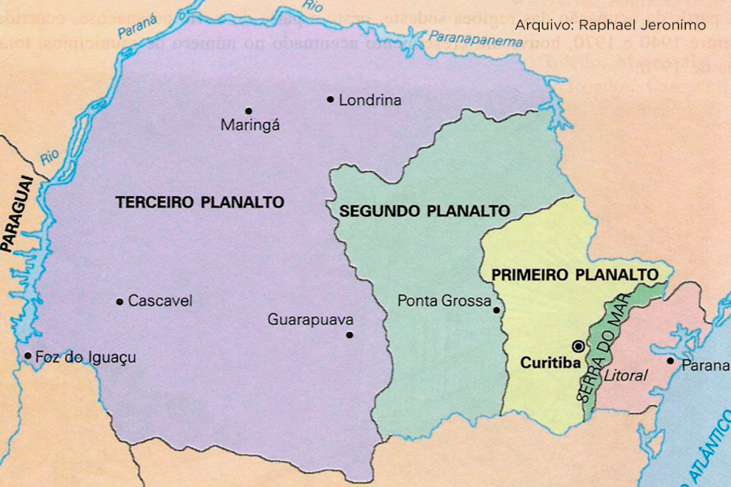
Paraná’s geological structure is extremely rich in relation to the soil variations that make up the region. It is divided between the three plateaus that are part of the State (image).

Across the First Plateau the highest incidence is of igneous and metamorphic rocks, which date from the Archean period and the beginning of the Paleozoic.They are resistant rocks and responsible for the strong relief and high slopes of the landscape. This part of Paraná is called Escudo Paranaense.
To the west, the Escudo is covered by a thick sequence of sedimentary and volcanic rocks, called the Paraná Basin. This sequence starts at the Escarpa da Serrinha (Serra de São Luiz do Purunã), reaching the western boundary of the state, covering the Second and Third Plateau. Its formation began in the Silurian period, ending in the Cretaceous Period. It is important to consider that the positions of the continents were very different from the current one. South America was linked to Africa, forming the megacontinent Gondwana and the Atlantic Ocean did not yet exist.

Pangea / Laurasia and Gondwana / Modern World
The evolution of the Paraná Basin – which lasted more than 350 million years – happened in great geological cycles, marks for advances and retreats of the coastline of an ancient ocean that bathed the supercontinent Gondwana. These changes enabled the formation of rocks of different origins, such as marine, lake, fluvial and glacial, important for the composition of the Paraná Basin.
During the Jurassic, this extensive basin turned into an immense desert (the Botucatu desert) with more than 1.5 million km2. This covered part of what is now southern Brazil, Paraguay, Uruguay and Argentina. JIn the Cretaceous period, the great rupture of the supercontinent Gondwana began, with the separation of the current South American and African continents, and the formation of the South Atlantic Ocean. This separation promoted the release of magma, forming extensive spills of basaltic lavas on the Paleozoic sedimentary units. These spills reached up to 1,500 meters in thickness and covered more than 1,200,000 km2. The alteration of these lavas results in the famous “terra roxa”, soil of high agricultural fertility. On these rocks, in the northwest of the State, the so-called Caiuá sandstones occur, formed at the end of the Cretaceous.

M.A: 445-419 m.a. / 145-66 m.a. / 201-154 m.a.
ERA: Paleozoica / Mesozoica / Mesozoica
Período: Siluriano / Devoniano / Cretáceo / Jurássico
Events:
– Appearance of the first terrestrial plants.
– First terrestrial animals (amphibians).
– Emergence of angiosperms / More than half of the dinosaur species lived in this period / Fall of the meteor that extinguished the dinosaurs and pterosaurs.
– Opening of the Atlantic Ocean (because the continents were separating) / Herbivorous dinosaurs / First mammals and birds.
Did you know?
According to the Paraná Department of Environment, if we put the entire life span of the Earth, 4.6 billion years, in just 1 year – 365 days – the man would have appeared almost at the New Year’s Eve party, at 8:14 pm of December 31st. That is, he would have lived only the last three hours and forty-six minutes of the year. To compare, dinosaurs lived more than 100 million years, equivalent to eight and a half days ago.
Geology of São Luiz do Purunã
São Luiz do Purunã is a region located exactly in the transition between the First and the Second Plateau of the State (image). The Serra de São Luiz do Purunã is a geographical accident located in the Campos Gerais region of Paraná.

The main geological formations that are part of our region are the Devonian Escarpment and the Ichnofossils. And now let’s talk a little more about each one!
Devonian Escarpment
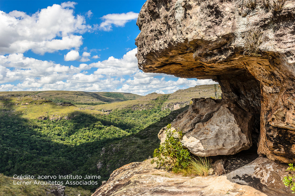
The Devonian Escarpment is a geological formation that delimits the First and Second Plateau of Paraná. The name, Devonian Escarpment, is due to the period of the rock formation that occurred 400 million years ago – in the Devonian period. However, the way it is today is more recent – 65 million years old – the result of the Cenozoic period.
The Escarpment begins in the valley of the Iguaçu River, in the south of Paraná, and goes ahead of the Itararé River, in the state of São Paulo. There are 260 km in length and unevenness between 100 and 200 meters. In the Canyon do Guartelá these differences can reach up to 450 meters. In the Escarpment, cracks and small caves can be found that hold archaeological remains (photo). The canyons of the Iapó, Pitangui, Itararé and Iguaçu rivers are also included in the formation.

Devonian Ichnofossils
According to the Secretaria de Estado da Cultura – Coordenação do Patrimônio Cultural, this is where an outcrop of the Furnas Formation takes place. In this formation, traces of invertebrate life are registered, which happened approximately 410-415 million years ago (beginning of the Devonian Period), in a relatively shallow marine environment.
This paleontological site, listed as geological heritage by the Brazilian Commission for Geological and Paleontological Sites, is located about twenty meters from the BR 277 highway, 42 kilometers from Curitiba (photo).

And due to its historical richness and value for geological research, the place is visited by universities, paleontologists and geologists. This happens not only because of the easiness of visualization and teaching, but also because of the extremely easy access.
Come live the history of our planet in São Luiz do Purunã
If you were inspired and curious to learn more about the history of the planet Earth from the contact with the natural beauties that are part of the Devonian Escarpment and Ichnofossils, São Luiz do Purunã is the right place for that. Schedule a visit and come breathe history and renew your energies with us.
Find out more about the travel possibilities to here by accessing the Visite Purunã. We’ll be waiting for you!

